Soil Explorer shares features with other web mapping programs, but there are differences as described below.
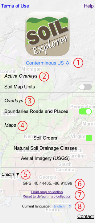
1. Select different regions or map collections.
2. Active overlays are used to display soil polygons or field trip routes. Active overlays can be queried like maps. If more than one active overlay is present, only one can be turned on at a time, or all can be turned off. Soil polygons can only be queried when they are visible.
3. Overlays are used to display features like political boundaries, roads, place names, rivers, streams, etc. Overlays cannot be queried, but if multiple overlays are present, more than one can be on at the same time.
4. Semitransparent maps of different soil properties are displayed on top of a hillshade base map that is optimized to show subtle variations in topography. Only one map can be selected at a time. Most, but not all, maps can be queried by clicking or tapping on the desired location on the map.
5. Source data, author(s), and other information about the currently visible overlays and map.
6. Your current GPS location in decimal degrees if you have allowed your browser to access your location.
7. Used primarily during development of new maps.
8. Change the language for the website. Three languages are supported, English, Spanish, and Quechua. This setting changes the language of only some of the labels and links, but not the language for the map names, class labels in the legend, or text within the popups that are displayed when the maps are queried. Currently, the Perú - Arequipa map collection is the only one in Spanish.
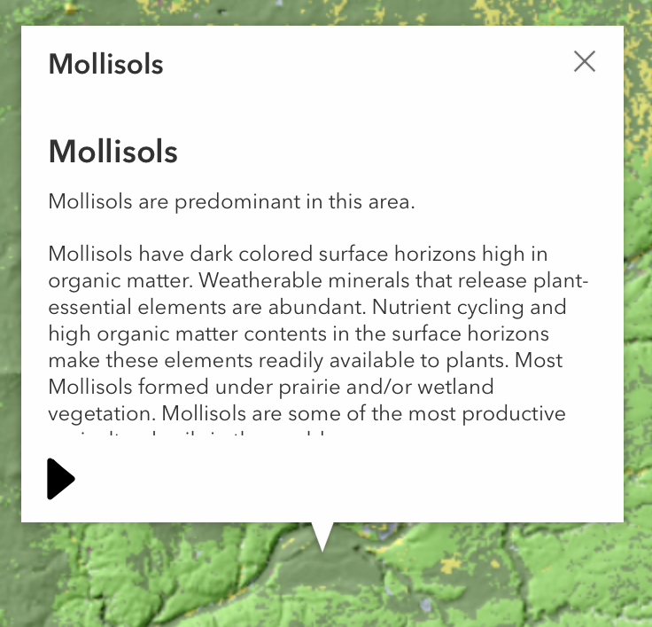
Click or tap a spot on a map to query the map at that location. The top line is the label from the legend, while the rest of the box, if present, contains additional information about that part of the map. Some maps like Aerial Imagery and Topograpy cannot be queried.
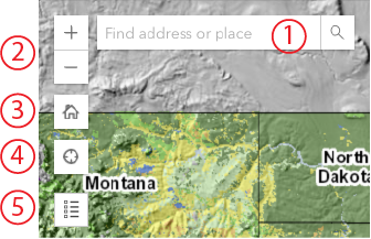
1. Search for a location. Enter an address or GPS coordinates.
2. Zoom in or out.
3. Reset the map to its initial extent.
4. Center the map on your current GPS location if you have allowed your browser to access your location.
5. Show the legend for the current map. When the legend is visible, the map becomes opaque so that the colors on the map can be matched to the colors on the legend more easily. Click or tap on the map to hide the legend.
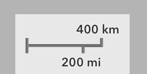
For the Mercator map projection used by Soil Explorer and other web maps, the map scale varies with latitude. Thus, the scale bar only matches the map scale for the part of the map directly under the scale bar.